The Indian Air Force’s C-130J Hercules, tasked with delivering aid to Myanmar after the March 2025 earthquake, fell victim to GPS spoofing, raising suspicions about the involvement of foreign actors in the disruption
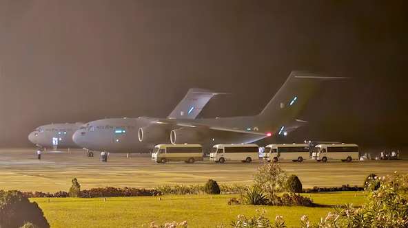
For the Indian Air Force pilots of the C-130J Hercules aircraft that took off from Hindon Airbase with tonnes of relief materials for Myanmar—struck by a 7.7 magnitude earthquake followed by intermittent aftershocks on March 29, 2025—the GPS spoofing encountered in Myanmar’s skies must have come as a surprise. Professional and well-trained as they are, they immediately switched to backup systems, ensuring the safety of both aircraft and crew. They effectively put their training to use under unexpected and challenging conditions.
The origin of this electronic interference is certainly foreign. It sends a clear message to those who attempted this below-the-belt attack on a military aircraft engaged in a peace mission.
The question is: who carried out these dirty attempts targeting aircraft involved in humanitarian missions to Myanmar?
Mapping GPS spoofing over Myanmar
Below is a screenshot from the website GPSJam.org, which uses publicly available flight data to identify areas of likely GPS disruption worldwide. On March 29, 2025, GPS interference levels were indeed high. This kind of interference is not unique to Myanmar, as reports from around the world have revealed an increasing frequency of GPS spoofing incidents. In late August of the previous year, for example, pilots in the West Asia or the Middle East, reported their navigation systems being hijacked by fake GPS signals, causing them to be thrown hundreds of miles off course. This type of interference resulted in a complete loss of navigational capability in some instances, forcing pilots to rely on air traffic controllers for directions, according to an article by Amy Mackinnon in Foreign Policy.
According to GPSJam.org’s data from March 29, there are strong indications of GPS spoofing or jamming activity in the skies over southern Myanmar—particularly around Yangon and the Irrawaddy Delta (marked in blue). A dense red cluster on the map marks areas with significant GPS interference (greater than 10 per cent), pointing to concentrated disruption of satellite navigation systems in that airspace.
These red zones—indicating high interference—are notably concentrated around Yangon and stretch toward the southern coastline. The localised and isolated pattern suggests deliberate electronic interference, possibly involving spoofing, jamming or other forms of electronic warfare. Spoofing, in particular, is a more dangerous phenomenon than jamming, as it involves the transmission of false signals that mislead aircraft systems into calculating incorrect positions. As experts have pointed out, spoofing is particularly dangerous because it can “infect” the aircraft’s inertial reference system (IRS), essentially disabling the aircraft’s ability to navigate properly as Mackinnon wrote in the Foreign Policy.
The Coco Islands: A strategic link
Of particular interest is the area’s relative proximity to the Coco Islands. Though under Myanmar’s control, these islands have long been subject to speculation about the presence of signals intelligence (SIGINT) and radar facilities. Located just north of Andaman and Nicobar Islands, the Coco Islands are approximately 300 to 400 kilometres southwest of the red hotspot. If equipped with long-range electronic warfare systems, installations there could potentially project interference into Myanmar’s mainland airspace.
The timing and geographic isolation of the interference—especially when the surrounding region shows minimal disruption—suggest a targeted activity. While the exact source remains unidentified, the pattern supports the theory that military or intelligence-linked installations may be involved, either on the Coco Islands or elsewhere in the region. As Todd Humphreys, a professor of aerospace engineering at the University of Texas at Austin, noted, the use of spoofing technology has become increasingly common in regions with heightened military tension, such as the Middle East and Eastern Europe, where it is used as a missile-defence technique, as reported in an article by Matt Berg for Politico.
Deliberate electronic warfare or random interference?
The GPS spoofing over Myanmar on March 29 appears deliberate and concentrated. The data points to a possible operational footprint extending from nearby strategic locations. Given recent developments and infrastructure upgrades in the area, the situation warrants further investigation and monitoring to determine the scope and intent behind the interference.
The possibility of degraded GPS availability was published by Mandalay International airport as NOTAM and all due precautions were put in place to cater for such conditions.
IAF crew are well capable to handle such unavailability, while ensuring safety of flight and achievement…
— Indian Air Force (@IAF_MCC) April 14, 2025
The IAF’s statement on April 14, 2025, acknowledging “temporary navigational anomalies” experienced by one of its transport aircraft near Myanmar on March 29, significantly reinforces concerns about active GPS spoofing or jamming in the region. This incident, analysed alongside independent GPS interference data and known developments on the Coco Islands, presents a compelling case for a coordinated electronic warfare presence affecting regional airspace.


